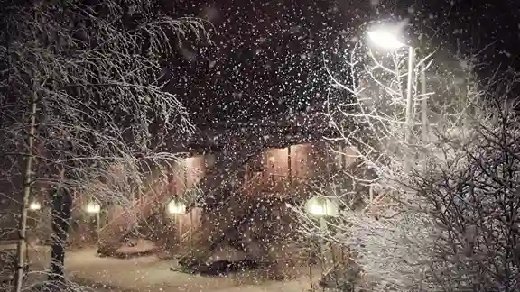
Is It Going to Snow Tomorrow? 2026 Snow Forecast & Probability Map
While our snow day calculator provides a statistical probability for school closures, the underlying question: is it going to snow tomorrow? is one of the most complex challenges in modern meteorology. Predicting a “Yes” or “No” for tomorrow requires an analysis of the entire vertical profile of the atmosphere, from the ground to the top of the troposphere.

The Three Atmospheric Pillars of Snowfall
For snow to reach your doorstep tomorrow, three specific ingredients must align with surgical precision. If even one varies by a single degree or a few miles, your potential blizzard transforms into a rainy afternoon.
The Freezing Profile (The Vertical Column): It is a common myth that it only needs to be 32°F (0°C) at ground level. In reality, the entire column of air must remain cold. Meteorologists look for a “Warm Nose” a layer of air above freezing a few thousand feet up. If snowflakes fall through this layer, they melt. If the air near the ground is cold again, they refreeze into Sleet (Ice Pellets); if not, they become Freezing Rain.
Saturation and Lift: Moisture is the fuel, but “Lift” is the engine. Lift is often provided by a Low-Pressure System or an Orographic Effect (air being forced over mountains). Without a mechanism to push moist air upward into the freezing layers of the atmosphere, the clouds remain “thin” and incapable of producing accumulation.
The Dendritic Growth Zone (DGZ): This is the “sweet spot” in the clouds, typically between $10$°F and $-4$°F. In this specific temperature range, ice crystals grow into Dendrites the classic six-sided snowflakes. If the storm’s moisture is concentrated in the DGZ, you get high “Snow-to-Liquid Ratios” (fluffy snow). If the moisture is outside this zone, you get small, needle-like grains that barely stick.
Understanding Global Forecast Models (GFS vs. ECMWF)
To answer “Is it going to snow tomorrow?” our 2026 algorithm analyzes the two primary global models that drive most weather apps:
The GFS (American Model): Operated by NOAA, the Global Forecast System is updated four times a day. It is known for its “progressive” nature, often predicting storms earlier than other models, though it can sometimes over-estimate snowfall totals in the long range.
The ECMWF (European Model): Widely considered the most accurate for winter storms, the “Euro” model has a higher resolution. When the GFS and ECMWF “agree” (model consensus), our calculator’s confidence score increases significantly.
High-Resolution Rapid Refresh (HRRR): For “tomorrow’s” forecast, we switch to the HRRR. This model updates hourly and can see “Mesoscale Snowbands” intense strips of snow only 10 miles wide that can dump 3 inches an hour while the next town gets nothing.
Why Forecasts Change: The “Bust” Factors
Even the best models face three major hurdles that can change a “Snow Tomorrow” prediction overnight:
Dry Air Entrainment: As a storm moves, it can suck in dry Arctic air from the north. This dry air evaporates the snow before it hits the ground a phenomenon known as Virga. This is why your radar might show blue (snow) but your driveway is still dry.
The Rain-Snow Line: In coastal cities like New York or Boston, the rain-snow line is a battleground. A shift of just 10 miles in the storm’s track can move the “mixing line,” turning a 10-inch forecast into a 2-inch slushy mess.
Ground Temperature Latency: In early winter (November) or late winter (March), the ground is often too warm for snow to stick immediately. Even if it “snows tomorrow,” it may melt on contact unless the snowfall rate exceeds 1 inch per hour.
Also Check: How Schools Predict Snow Days Using Weather Data?
Regional Indicators: What to Watch For
The South (Dallas to Atlanta): Watch for “Overrunning” events, where warm, moist air from the Gulf of Mexico slides over a shallow layer of Arctic air. This is the classic recipe for southern ice storms.
The Midwest & Great Lakes: Lake Effect Snow is the wild card. Cold air blowing over the relatively warm Great Lakes can create “Snow Squalls” sudden, blinding bursts of snow that don’t appear on traditional long-range models.
The Northeast Corridor: Watch the “North-East” wind. A true Nor’easter pulls moisture directly from the Atlantic. If the wind stays NE, you stay in the “Cold Sector.” If it shifts SE, the “Atlantic Taper” brings in warmer air and ends the snow.
Final Verdict
When you ask, “Is it going to snow tomorrow?”, you are really asking about Risk Management. Our algorithm doesn’t just look at the sky; it looks at the Predictive Probability across 50 different model “ensembles.” If 45 out of 50 versions of the future show snow, your probability is high. If only 10 show snow, the forecast is “unstable.”
Frequently Asked Questions
1. Can weather apps predict snow accurately?
Yes, modern weather apps use advanced technology to provide accurate predictions. However, they are not infallible due to sudden atmospheric changes.
2. What should I do if heavy snow is expected?
Stock up on essentials, avoid travel, and prepare your home for potential power outages. Stay informed through reliable weather updates.
3. Why does snow sometimes turn into rain?
This happens when temperatures rise above freezing, causing snowflakes to melt into raindrops before they reach the ground.
4. How can I tell if it’s going to snow without a forecast?
Signs like a sudden drop in temperature, frost on surfaces, and heavy, dark clouds often indicate that snow might be on the way.
5. Does global warming mean less snow everywhere?
Not necessarily. While some regions may see less snow due to warmer temperatures, others might experience heavier snowfalls due to increased moisture in the atmosphere.